000
AXPZ20 KNHC 140230
TWDEP
Tropical Weather Discussion
NWS National Hurricane Center Miami FL
0405 UTC Tue May 14 2024
Tropical Weather Discussion for the eastern Pacific Ocean from
03.4S to 30N, east of 120W including the Gulf of California, and
from the Equator to 30N, between 120W and 140W. The following
information is based on satellite imagery, weather observations,
radar, and meteorological analysis.
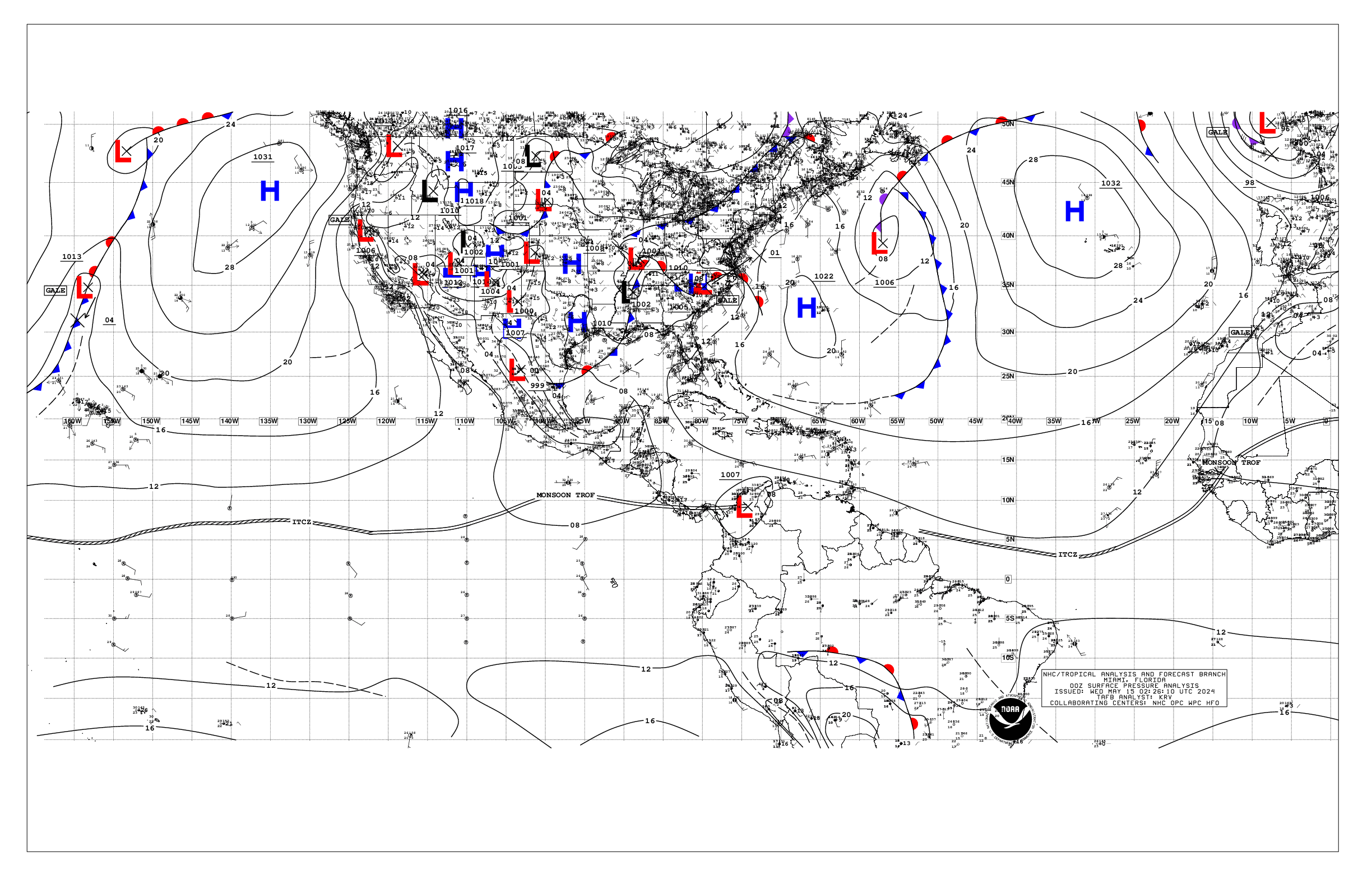
Based on 0000 UTC surface analysis and satellite imagery through
0230 UTC.
...INTERTROPICAL CONVERGENCE ZONE/MONSOON TROUGH...
The monsoon trough extends from the coast of NW Costa Rica near
10N86W to 11N106W and to 07N121W. The ITCZ continues from
07N121W to beyond 07N140W. Scattered moderate to isolated strong
convection is observed from 05N to 15N between 85W and 110W.
Scattered moderate convection is noted from 03N to 09N between
131W and 140W.
...OFFSHORE WATERS WITHIN 250 NM OF MEXICO...
Gentle to moderate winds prevail across the open waters off
Mexico with light to gentle winds over the Gulf of California.
Seas are in the 4-6 ft range over the open waters off Mexico, and
3 ft or less in the Gulf of California.
For the forecast, gentle to moderate NW winds, pulsing to locally
fresh each night, and moderate seas or less, will persist off
the Baja California waters through this week and into the
upcoming weekend. Pulsing of moderate to locally fresh gap winds
will push through the mountain passages of Baja California into
the Gulf of California at night through much of the week. Gentle
to locally moderate winds and moderate seas are expected
elsewhere across the open offshore waters of Mexico through late
this week.
...OFFSHORE WATERS WITHIN 250 NM OF CENTRAL AMERICA, COLOMBIA,
AND WITHIN 750 NM OF ECUADOR...
Gentle to moderate winds are over the waters S of the monsoon
trough, with light to gentle winds N of the monsoon trough. Seas
are in the 4-6 ft range, locally to 7 ft S of the Galapagos
Islands.
For the forecast, gentle to moderate southerly winds are
forecast south of the monsoon trough through the end of the week.
Southerly swell moving through the regional waters will support
seas of 5-7 ft south of the Galapagos Islands through the
forecast period. An area of low pressure may form south of the
Gulf of Tehuantepec by mid to late week and move west-
northwestward. This will increase the winds and seas in the
offshore waters of Guatemala and El Salvador toward the end of
the week and into the upcoming weekend.
...REMAINDER OF THE AREA...
High pressure prevails N of 20N. The pressure gradient between
the area of high pressure and lower pressure in the vicinity of
the ITCZ is supporting moderate tradewinds N of the ITCZ to near
20N and W of 120W. Seas in this area are in the 6-8 ft range.
Light to gentle winds are elsewhere N of the ITCZ/monsoon trough,
where seas are in the 4-6 ft range. Gentle to locally moderate
winds are S of the ITCZ/monsoon trough where seas are in the 5-7
ft range.
For the forecast, moderate to locally fresh trade winds and
moderate seas are expected in the trade wind zone N of the ITCZ
to near 20N and W of 120W through the forecast period. An area of
low pressure may form south of the Gulf of Tehuantepec by mid to
late week and move west-northwestward. This will increase winds
and seas in the eastern part of the basin toward the end of the
week into the upcoming weekend.
$$
AL


